Sunday, September 30, 2012

Death Valley National Park

Death Valley National Park is known as the hottest, driest, and lowest place in North America.  Annual precipitation is below 2 inches and some years have recorded no rainfall,  but annual evaporation rate is 150 inches per year!  In 2001, there were 154 consecutive days above 100 degrees.

The depth and shape of Death Valley influence its summer temperatures. The valley is a long, narrow basin 282 feet below sea level, yet is walled by high, steep mountain ranges. The clear, dry air and sparse plant cover allow sunlight to heat the desert surface. Heat radiates back from the rocks and soil, then becomes trapped in the valley's depths. Summer nights provide little relief as overnight lows may only dip into the 85°F to 95°F range.

Here's a photo of one of the famous 20 mule team rigs used to haul borax, a salt mineral, to market...


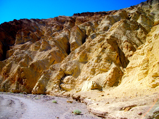
I hiked up Golden Canyon, where the reason for its name quickly became apparent...


Artist Drive was a lengthy one-way road with scenes like this...


Water is rare and precious in death Valley, so when a surveyor couldn't get his mule to drink from this rare pool of water, he named it "Badwater Basin."  The water isn't really bad, just very salty.  This is the lowest place on our continent at  282 feet below sea level. 


A boardwalk keeps you from the pool of water, but you can walk the salt flats as seen here...


These barren salt flats represent the hottest, driest, and lowest elevation salt flats in North America, and served as a location for the filming of "Star Wars."


Mining companies have long ago departed this area, but a new wealth has replaced it: Tourism. People from around the world visit this well-known national park, the 50th I've visited of our 58 national parks.



Friday, September 21, 2012

Biking The Jordan River Trail in the Salt Lake City Area

The Jordan River Parkway follows the namesake river starting at the north end of Utah lake, and when completed will travel 40 miles through Salt Lake County to Davis County. There are over 20 trailheads for access, many with restrooms and water and some with playgrounds and picnic facilities.


There are many turnoffs for access from neighborhoods.  Many have vertical posts with info etched in, but many of these are nearly unreadable now. Some segments have painted yellow center lines at all intersections indicating where the main trail goes. It would help if they used this system uniformly on the entire trail, but since numerous municipalities are involved, this may not occur.

An equestrian trail travels alongside the paved trail for one segment. But Salt Lake City trails can have goatheads that puncture your tires (one got me) so I wouldn't try biking the gravel horse trail in late summer or fall season.

The trail takes you past many parks, some wood lots, water detention areas, a large community garden, electric sub-station, much preserve area (perhaps flood-plain areas,) a few housing areas, golf course, industrial buildings, and even some sections with lighting.


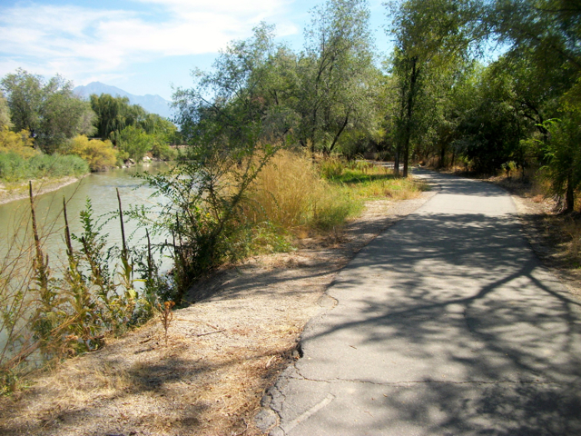
Most road crossings are via under- and over-passes.  Occasional gang graffiti is evident.  You often get views of the Jordan River as seen here...


The trail is mostly in good condition, with some root heaves.  A sensitive area south of Murray-Taylorsville Road (perhaps prone to flooding) has this extensive boardwalk to raise the trail above the land.


Infrequent signs provide history of the area and are interesting to stop to read.

Official website with downloadable maps.


Trailhead parking can be found here:

Hwy. 171 at South 1000 West at James Madison Park

1585 West (Lester Street) and 3100 South Street

Redwood Park -- State Route 201 west of I-15

Across from 7 Peaks Water Park on West 1700 South

Murray-Taylorsville Road just west of Murray Blvd. at the Jordan River

Germainia Park  has 2 lots at 5400 South and 1070 West Street

Cottonwood Grove and Walden Park on either side of 5800 South west of Murray Blvd. Parkway
North of 3700 South Street on 700 West, i block and turn west on Carlisle Park Lane (aka 3800 South) to get to Holm Park trailhead (where the street dead-ends.)

Hoover Dam

I've been to Hoover Dam four times, but not for about 10 years. After 9/11, the government realized the vulnerability of the dam to a terrorist attack since a major US highway traveled over it, including trucks, RVs, and cars, so planning began for a bridge downstream to take traffic off the dam (ala Glen Canyon Dam and bridge.) The old highway had also slowed through-traffic by 30 minutes or more and created huge congestion problems over the dam.

Here's a photo of the finished project. A major reroute of highway 93 (Great Basin Highway) was also required.  


Planners included a pedestrian walkway on the dam side of the bridge, accessed by a switchbacking ramp or optional stairs to get visitors from the parking lot (located on the old road which takes visitors to the dam, now called Hwy. 172 or Hoover Dam Access Road) to the bridge level. The bridge has been named to honor a former governor (Mike O'Callaghan) and former football star turned Army Ranger, Pat Tillman.)  Several dozen interesting displays explain the design and construction of the bridge and give info on the two honored men, both of whom died in 2004.  The bridge and bypass highway were opened in 2010.


The pedestrian walkway affords visitors with an ideal viewing platform from which to observe the dam as seen below.  Click to enlarge photo and you'll see the new five story parking garage on the far left of photo. They had to blast out more mountain to build it and re-route thad to re-route the old highway a bit, now seen as a bridge between the garage and cliff edge.  A gift shop and restaurant are also available now.


Last time I was here I had an even better view.  I was on an Elderhostel four day kayaking program and we used a dam service road to reach the river and our put-in right at the bottom of the dam, from where we paddled 40 miles through Black Canyon, camping three night and taking hikes up side canyons. Here are photos of that trip.


Here's a view of Lake Mead and the marina...


There have been a number of changes since my last trip here. First, the five story parking garage has been constructed which helps alleviate parking concerns. Of course, they charge you to use it ($7.)  Then you have a serious security check to get into the new and improved Visitor Center, much like at an airport.  Unfortunately, they also charge for entrance to the Visitor Center, another $8 -- guess they have to pay it off, too.  Then, the once free and later quite inexpensive dam tours are now $35.


Sunday, September 16, 2012

Biking the Tetons: Road Scholar Program

This Fall, a new offering in the Road Scholar catalog was "Biking the Tetons," and the week it was offered perfectly fit into the time I was to be in the vicinity, so I enrolled and thoroughly enjoyed the week. 

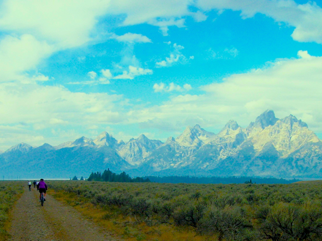
The first ride was a 20-miler called the "Teton View Tour" and followed the gravel boundary road between Grand Teton National Park and Teton-Bridger National Forest, with the former on your right and the latter on the left.  Though much of the ride at the start was through a sagebrush plain, the unobstructed views of the Teton Range were marvelous as evidenced here (the haze is from a large wildfire being fought south of Jackson)...


We then took a paved road down to the valley floor to see Mormon Row where 11 families settled in the early 1900s to farm and raise cattle.  A ride through another sagebrush prairie (where we observed four pronghorn antelope loping) took us to our lunch spot at Kelly Warm Springs where we observed anther pronghorn antelope.


On day two, we biked 16 miles in Buffalo Valley from Highway 287/26 on another gravel road, mostly downhill, past Turpin Meadow campground.  The road then became a lightly traveled paved road along Buffalo Fork River back to highway 287/26.


Ride three was 24 miles on pavement in Teton National Park, starting on highway 191, turning onto and following Teton Park Road from Jackson Lake Junction and then on the very scenic one-way Jenny Lake Road to South Jenny Lake area, where we had lunch.  We then rode the new Teton Multi-use Pathway, all the time in sight of views as seen below (which is Mt.Moran)...


The photo below is on the one-way road...


We finished the ride with time to see the exhibits at the new visitor center at Moose, from which this photo was taken...


Day 4 was high-country mountain biking 19 miles on the Flagstaff Creek forest service road, a very hilly, up and down, loose gravel road, that ultimately lost 1400 feet in altitude, finishing at the Hatchet Motel. The fall colors were just beginning as seen here...


A single track option was offered to us partway down the road, and five of us availed ourselves of the opportunity, covering several miles through woods, along willow wetlands, and across lovely high mountain meadows...

Here's the entire stalwart crew of mountain bikers...


Kneeling (l to r): Don, Neil, Jan, Sarah, Ann, and Dave
Standing: Don, Joan, Dick, Karen, Rob, Pam, Martha, Cindy (our program coordinator), 
Chuck, and Tom


Here's a video of our adventures during the week...


62 downloadable photos are available here. (Click photo you want and choose download)

Our coordinator, Cindy, gave informative and interesting powerpoint lectures on Teton habitats, geology, fall flowers and berries and animal adaptations to weather changes, and finally on the management of the Greater Yellowstone Ecosystem. She also showed two outstanding videos, one detailing the work of local activist Mardy Murie (often called "grandmother of the conservation movement" by the Sierra Club and Wilderness Society) and the other on the creation of the national park.

Lodging was at Togwotee Mountain Lodge in Moran, WY, and buffet breakfast and each evening's supper were provided by he lodge (and all were excellent!)  Delicious and filling box lunches were provided during each bike ride.

The bikes and guides were provided by Teton Mountain Bike Tours out of Jackson, Wyoming.


Sunday, September 9, 2012

Wildlife of Yellowstone National Park

(click to enlarge photos)


"Bison Jam" on Grand Loop Road
(only a 10 minute delay -- I've been in 30 minute delays on other visits)


Elk herd at West Thumb River (bull elk on right and his harem on left)


Hare


Another bull elk bulging 


Bison


This bull elk is on the campsite adjacent to mine.  He sat there over 30 minutes chewing some bark from a tree on the other side of my campsite, just sitting there and watching me (and other campers who came to take his photo.) He has 7 points on one antler and 8 on the other if you are trying to count.


Young elk just starting antler growth.


Waterfalls of Yellowstone National Park


Gibbon Falls (closeup and afar)


Upper Falls of the Grand Canyon of the Yellowstone River


Firehole Falls


Kepler Cascades


Lewis Falls


Lower Falls of the Grand Canyon of the Yellowstone River


Moose Falls


Virginia Cascades


Wednesday, September 5, 2012

Pompeys Pillar National Monument

Pompeys Pillar National Monument is a unit of the Bureau of Land Management and is adjacent to I-95 about 25 miles east of Billings, Montana. The massive sandstone outcrop rises 150 feet high and is two acres in size. It became a National Historic Landmark in 1965 and a National Monument in 2001, but it has had historic significance for over 11,000 years as a useful observation tower, as well as the only major sandstone formation on the south south of the Yellowstone River, and a landmark for the only natural ford of that river.


It was also a focal point for Captain William Clark of the Lewis and Clark Expedition. On their return journey from the Pacific Ocean in 1806, they split up to explore two different routes back. Clark was exploring the Yellowstone River route and was amazed by this "remarkable rock" with its "extensive view in every direction."  He marked his presence by engraving his name and date as seen here...


Clark named it "Pompy's Pillar" after Sacagawea's child,  Jean Baptiste Charbonneau, whom Clark affectionately nicknamed "Pomp" meaning "little chief" in the Shoshoni language. When his journal was published in 1814, it got the spelling "Pompey's."  The Indians called the tower "Where the mountain lion lies."


The top can be easily reached via stairs form the modern and informative Visitor Center structure, complete with movie, museum, and gift shop...


...and the views from atop are outstanding...


Theodore Roosevelt National Park

"I would not have been President if it had not been for my experiences in North Dakota," Theodore Roosevelt remarked when reflecting on the influences that shaped his life.  He loved this "land of vast silent spaces, a place of grim beauty."

Young Teddy Roosevelt was born into a wealthy Manhattan family, but was a sickly, asthmatic child and his father got him interested in exercise and boxing and outdoor pursuits including hunting and backwoods hiking and canoeing. to overcome his weaknesses.  And it worked, strengthening his body, but also had the fringe benefit of imbuing a passion for outdoors and for the environment and wildlife.

He idolized his father, TR Sr., and his father's death dealt him a tremendous blow.  He was also tiring of the difficulty of hunting in the mountains and underbrush of Maine, so he headed out west to North Dakota to hunt bison and other big game on the broad, easily accessible open prairies, to "live the strenuous life" as he put it.  He fell in love with he area and even went into partnership with two friends and started a cattle ranch, which he then left in their capable hands when he later returned to New York.  He later returned and bought a second ranch for himself.  

Back home, in 1884, unimaginable tragedy struck when both his wife and mother died in his house on the same day (of kidney disease and typhoid fever, respectively), and shortly thereafter, his political party faltered, so Teddy, in desolation at these losses, retreated to the solitude of his beloved Dakota Badlands.  

Theodore Roosevelt National Park honors his time here, and also his environmental ethic gleaned and developed and solidified here. Upon his return, he found his beloved buffalo decimated, and the overgrazing of cattle had  caused the destruction of the fragile Dakota grasslands. This decimated habitat vital to small mammals and songbirds.  Later as president, he remedied these situations, creating the U. S. Forest Service, and  utilizing Congress and also the Antiquities Act to declare 18 national monuments and the nation's first 51 wildlife refuges, 5 of our national parks, and 150 national forests protecting 150 million pristine acres.

Vistas in the North Dakota Badlands resemble those in the more famous South Dakota Badlands with the exception of more greenery here, thanks to 15 inches of annual moisture and the presence of the Little Missouri River.


My favorite wildlife are the abundant black-tailed prairie dogs...


...and the ubiquitous bison herds that were successfully re-introduced in 1956...


In 1985, elk were re-introduced, and the growth of their herds has been so successful that many Roosevelt Elk have been "transplanted" to other areas in the country. Wild horses also dominate the landscape here.

Below are photos of the Little Missouri River from up high atop Wind Canyon Overlook...


Teddy also:

...was called the Rough Rider for leading the 1st Volunteer Cavalry up San Juan Hill in Cuba during the Spanish-American War.   He was an African big-game hunter . . . an Amazon explorer . . . and a prolific chronicler of his adventures who authored 42 books, including his classic "The Wilderness Hunter," which is still in print. He was a founder of the National Collegiate Athletic Association and hunting's Boone and Crockett Club . . . governor of New York . . . father of the Panama Canal and "big stick" diplomacy . . . inspiration for the teddy bear. He was the first president to fly an airplane . . . to submerge in a submarine . . . to own a car . . . to have a home telephone . . . to travel outside the country while in office . . . to entertain an African American (Booker T. Washington) in the White House. And he was the winner of the 1906 Nobel Peace Prize for mediating the Russian-Japanese War.


Biking the Hay Creek Trail of Bismarck, ND


The Hay Creek Trail wends its way through a native creek landscape and curves around part of the perimeter of the Pebble Creek Golf Course.  It is paved, but its advertised 5 mile length includes 2 sides of the loop being on streets.  The area is quite hilly and provides a good workout.


Here's a view of Hay Creek which is crossed a couple times...


Bismarck has a number of short loop trails across the city for residents to enjoy, but all are short loops more conducive to walking than to getting in a long bike ride on trails. Below is a map of their trail system (click to enlarge)...


The trail is easy to find.  Exit I-95 at Highway 83 and drive north to the first street, Interstate.  Turn right and drive to its end at the Fore Seasons Center lot, which is small.  If crowded, drive a few hundred feet south, turn right and park by the new ball fields.