Wednesday, December 31, 2008

My New Year's Resolutions

The tradition of New Year's Resolutions goes back to 153 B.C. The Romans named the first month of the year after the mythical king Janus (January), the god of beginnings and the guardian of doors and entrances. He was always depicted with two faces, one on the front of his head and one on the back, allowing him to peer backward and forward at the same time. Hence, Janus became the ancient symbol for resolutions.

Though I have never put stock in proclaiming what too often are merely temporary personal improvements, I relent now and begin 2009 with these lofty aspirations:


Obey signs which give specific directions:


Make renewed efforts to attain towering heights:


Eat healthier:


Take a cruise:


Exercise regularly:


Respond to those ubiquitous emails which promise to provide physical enhancements:


Take singing lessons:


Study carpentry and then make those needed home improvements:


Lose weight:


Take up a sport:


Learn more about global warming:


Learn to relax more:


Enhance my computer skills:


Make time for naps wherever I am:


Travel to foreign countries:


Learn to follow directions better:


Have more respect for our national politicians:

Monday, December 29, 2008

Millennium Trail extensions of Fall, 2008

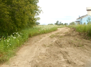
The first extension extends the trail a mile beyond the Fish Lake Road/Gilmer Road Trailhead parking lot. The segment is under the auspices of the Forest Preserve District though at least part of the extension was paid for by the Village of Volo as part of a land-swap agreement. As seen in this photo, the trail is paved, indicating horses will not be allowed west of the trailhead.


The trail weaves across a former corn field and then travels between the Autumn Grove and Symphony Meadows sub-divisions as seen below. Though unfinished in this photo, the trail was paved a few month later.


As I understand it, the Village of Volo is responsible for this segment through the sub-division, then up a wooded hillside and down the other side as it circles in front of the new Volo Village Hall. It then parallels Fish Lake Road, crosses Route 60, over to and across Route 120, and then north along Fish Lake Road to the as yet undeveloped Marl Flat Forest Preserve. The new paved extension at this point is built atop the new buried Nicor gas pipeline. Continuation into Marl Flat Preserve will be a future construction project, hopefully in 2009.

The second extension is a 2 mile long spur trail heading east between Route 176 and the dog exercise area, from the 176/Fairfield intersection...


... and then into and through the former Four Winds Golf Course property to Gilmer Road. A future underpass will take the trail under Gilmer and into the undeveloped Ray Lake Farm Forest Preserve. The section of the trail through the golf course is sited on a magnificent wooded hillside of mature trees and includes water features. A bridge is being constructed over a finger of the lake, and the former golf cart paths add additional mileage to a ride or walk there.


Thanks to the Lake County Forest Preserve District for acquiring and developing these new lands!

What a difference a weekend makes...

...when the temperature reaches 60 degrees during the winter. Friday we hiked in 18" deep snow and today many areas were snow-less and the deer were everywhere. Compare these photos today with those of just 3 days ago found here. Six of the several dozen deer we saw are in this photo...


Some areas still had a bit of snow, and a bunch were treacherously icy. I nearly fell at least a half-dozen times, but was happy to discover my balance-recovery reflexes and muscles were still operational. Below you see Ellen, Patti, and Dave working their way up one of the hills...

The warmth and 2 days of rain melted most of the snowfall, creating headaches for some of the residents near major waterways. The storms put Chicago over the old record for precipitation total for the year.

Sunday, December 28, 2008

Did Santa make it...

...to your house?

I hope so,

but if he didn't -- perhaps this is why...


Revenge is a dish best served cold

She spent the first day packing her belongings into boxes, crates and suitcases. On the second day, she had the movers come and collect her things. 
On the third day, she sat down for the last time at their beautiful dining room table by candle-light, put on some soft background music, and feasted on a pound of shrimp, a jar of caviar, and a bottle of spring-water. 
When she had finished, she went into each and every room and deposited a few half-eaten shrimp shells dipped in caviar into the hollow of the curtain rods. 
 
She then cleaned up the kitchen and left.


When the husband returned with 
his new girlfriend, all was bliss for the first few days.
 Then slowly, the house began to smell. They tried everything; cleaning, mopping and airing the place out.
 Vents were checked for dead rodents and carpets were steam cleaned.
 
Air fresheners were hung everywhere. Exterminators were brought in to set
 off gas canisters, during which they had to move out for a few days, and in 
the end they even paid to replace the expensive wool carpeting. Nothing worked.


People stopped coming over to visit.
 Repairmen refused to work in the house.
 The maid quit.


Finally, they could not take the stench any longer and decided to move.


A month later, even though they had cut their price in half, they could 
not find a buyer for their stinky house.
 Word got out and eventually even the local realtors refused to return 
their calls.
 Finally, they had to borrow a huge sum of money from the bank to purchase 
a new place.


Then the ex-wife called the man and asked how things were going.
 
He told her the saga of the rotting house. She listened politely and said 
that she missed her old home terribly and would be willing to reduce her divorce settlement in exchange for getting the house back.


Knowing his ex-wife had no idea how bad the smell was, he agreed on a
 price that was about 1/10th of what the house had been worth, but only if 
she were to sign the papers that very day.
 
She agreed and within the hour his lawyers delivered the paperwork
. 
A week later the man and his girlfriend stood smiling as they watched the 
moving company pack everything to take to their new home.


And to spite the ex-wife, they even took the curtain rods!

Saturday, December 27, 2008

Arches National Park

Arches National Park began as a national monument in 1929 and was elevated to national park status in 1971. It covers 119 square miles, or 76,115 square acres. Elevation ranges from around 4000 feet to 5653 feet in height. No on knows for certainly how many arches are within the park, but over 2000 natural arches have been recorded and some fall or are being created regularly. The first few miles as you drive up the big hill and enter the park's upper reaches, you experience countless sights such as this...


We hiked to, around, and up next to Balanced Rock seen below...


The plan had been to camp at Arches and Canyonlands National Parks this week and do a lot of hiking and biking, but the 100+ degree temperatures forced a change of plans. Instead, we are in a motel in Moab and got an early start this morning to hike to several of the arches. The plan sort of worked -- the temp was only 84 when we began the 2 hour, 3 mile trek to Delicate Arch (elevation gain of 500+ feet), but it was already 94 degrees during the hike back, and we felt it. The arch was well worth the effort, though, as seen below...


Petroglyphs are also extant in the park, as seen here, with horse, rider, and big horn sheep carved by the indigenous Ute tribe 350 years ago...


We also hiked the half mile to Skyline Arch, which just 68 years ago became a top attraction after an immense section fell out of the arch and more than doubled the opening's size...


Back in 1990, my sons and I hiked up to the arch and sat right under it...


Finally, below are several more shots of the hundreds of miscellaneous arches and spires we saw...

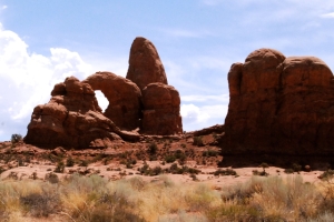


Click here for more Arches NP photos.


Canyonlands National Park

This afternoon, we drove over to Canyonlands NP despite threatening skies, and walked a number of short trails to overlooks and viewpoints. This park "preserves a colorful landscape eroded into countless canyons, mesas and buttes by the Colorado River and its tributaries." With only 10 inches of precipitation a year, it is arid high desert with panoramic vistas, as seen here overlooking Shafer Trail.


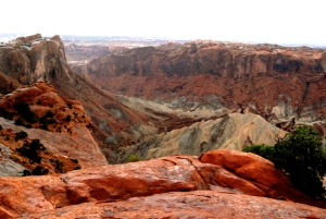
Upheaval Dome is 3.4 miles deep and 2 miles across, and scientists can't agree if it was caused by a meteor strike or a salt dome upheaval...


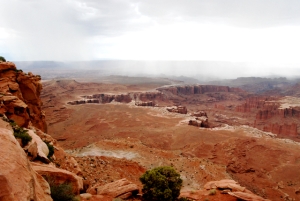
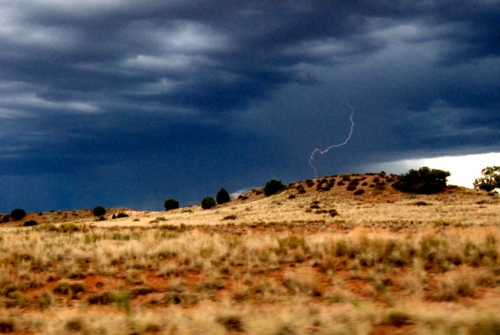
Two more overlooks are represented in these 2 shots. The storm is dead center in this shot, and though lightning bursts were prevalent, we couldn't capture one in a photo. The Green River is far off but the storm haze prevented a photo. Saturday we leave on a 9 day canoe trip down 120 miles of the Green River, half of which will have us in Canyonlands NP, but seeing the sights from a quite different perspective at water-level.


It did drizzle on us a few times, and Ellen was finally able to catch the end of a lightning strike as we drove, seen in this shot if yo click to enlarge and look closely...


Then it was back to Moab for a buffet of salad, soup, and pizza at Zax.

Here are links to our canoe trip (120 miles in 9 days) down Utah's Green River, over half of which was through Canyonlands National Park. Three posts with photos are dedicated to that trip:

1) Part 1 -- the start of the trip
2) Part 2: The Anasazi ruins found along the river
3) Part 3: Interesting facts about river trips

Biking in Moab

In August we were in Moab and I had to blog on WordPress because Blogger had locked me out. So in "honor" of our already harsh winter weather, I've decided to move some of those warm-weather posts from WordPress to here.

Moab, Utah is arguably the mountain biking mecca of the country. However, even the easiest rated trails have 500 or more feet of elevation gain and the desert environment and 90+ degree temps make for strenuous biking. So instead, we biked IN Moab -- touring residential areas and making our way to the north edge of town and the trail to the Arches National Park entrance, 7.5 miles one way. Here's the new bridge to take the bikes over the Colorado River...


... and here's a side channel of the Colorado below the bridge and the awesome rock formations lining the banks...


Then Ellen's bike got a flat. I biked back to the motel and drove the van to pick her up. Next came a tasty lunch at the Moab Diner, followed by replacing the bad tube. We decided to take another jaunt on the bikes despite the 90+ degree heat, and Ellen made a new biking buddy...


... and we biked another 5 miles in the 90+ degree heat through more residential areas and came upon the lovely Mill Creek Parkway Path seen below...


That made a grand total of nearly 20 miles for the day, over 300 for the month, and over 1900 for the year. Tomorrow we raft all day on the Colorado, so check out those pictures tomorrow night.

Negro Bill Trail and Morning Glory Natural Bridge Photos

In August we were in Moab, Utah and I had to blog on WordPress because Blogger had locked me out. So in "honor" of our harsh winter weather, I've decided to move some of those warm-weather posts from WordPress to here.

Today was another fairly early start to beat the afternoon heat. It was 79 degrees when we started before 9am -- and 91 degrees 3 hours later when we finished (and 100+ later in the afternoon!) The hike is 4+ miles round trip and traverses the beautiful Negro Bill Canyon and then a side canyon to the natural bridge. William Granstaff, for whom the canyon is named, settled in the Moab area in 1877 and was one of the first non-Native Americans to live here.


The hike is on Bureau of Land Management land and they are waging battle with the invasive Tamarisk, which has displaced native vegetation on 1.6 million acres of our western lands. After 20 years of study, various agencies have imported Tamarisk leaf beetles to defoliate the plants without affecting any other plant or animal species. I read that a large tamarisk plant can have a root system 100 feet deep and can consume thousands of gallons of river water daily! Below shows the successful result of the battle in one section of this canyon...


There are about 8 easy creek crossings on the hike...


Morning Glory Natural Bridge is 243 feet in length, making it the sixth longest rock span in the country. The pool below it somewhat reminds me of Morning Glory Pool in Yellowstone's Old Faithful area, making me wonder if that accounts for the bridge's name. The bridge is adjacent to the nearby cliff face but is only connected to the mountain on the 2 sides (you can see light between the bridge and the cliff.)


We saw people atop the bridge, and then 10 minutes later they began rappelling down the cliff face and joined us on the ground as seen here. (They were with an outfitter and they drove and hiked up top to get to the cliff.)


Friday, December 26, 2008

Trudging through snow...

... is quite strenuous when it is 12+ inches deep. We met Patti and Dave at Lakewood and hiked for 90 minutes today. After 10 minutes, I asked, "Why aren't we using our snowshoes?"


We all had assumed the snow would have been packed down by equestrians and other hikers. Sure, we'd had 12+ inches over a 30 hour period, but that had been back on Tuesday and Wednesday. With the foot-plus already on the ground, we've had way above average in December, and we discovered we were wrong -- few had preceded us through the woods and the pristine snow, though beautiful, was so deep we had to post-hole quite a bit, at times finding the depth was well up our thighs and once up to my knees. We spotted over a dozen deer which were also post-holing, though at a far speedier pace and making it look effortless! Here's a shot Ellen took of my legs showing my high hiking boots completely in the snow and my jeans saturated up to the knee...


It WAS a great workout, followed by a nice lunch at Culver's, and then some shopping.

Catnip Unnecessary...

... because M&M found this package amongst the dozens that were under the tree and claimed it as her own. In this photo...


... you see the result of a week or more of her "working" on "her" box. She has stripped off much of the wrapping paper, gotten the box open, and in the photo shows her head inside it. The box was empty, which was why we allowed her to continue to mess with it. It had been a prop I had wrapped for one of the scenes in our church Christmas production last week.